|
|
|
|||||||


| Project Camelot General Discussion Reactions, feedback and suggestions on interviews, current events and experiences. |
 |
|
|
Thread Tools | Display Modes |
 01-20-2009, 11:13 PM
|
#1 |
|
Avalon Senior Member
Join Date: Nov 2008
Location: Germany
Posts: 1,151
|
Greetings Avalonians,
This thread is to gather more detailed information about single sites and to figure out who goes where (and why?) and possibly arrange meetups, discover new sites. All that. Here is the pre-emptive list: (UPDATED 1-27-09) Albania: Tassili n’Ajjer Algeria: Tanger Antarctica: Lake Vostok Argentina: Parana Australia: Bundooma Spiral,Pine Gap,Alice Springs Uhuru(Ayers Rock) Belize: Altun Ha Lamanai Lubaantun Brazil: Itaituba Mexiana Xingu,Culuene Bolivia: Tiwanaku Tihu Anaku Cambodia: Angor Watt Preah Khan Preah Vihear Canada: 1. Basilica of Ste. Anne de-Beau pre' 2. Soldier mountain (sacred to Ajumawi indians), Fall River valley 3. Montreal; St. Joseph's Oratory 4. Chief mountain, near Ft. Macleod 5. Mt. St. Elias 6. Great Sandhills, south Saskatchewan 7. Wanuskewin, 5 km north of Saskatoon 8. Moose mountain medicine wheel 9. Walbran valley, west coast of Vancouver Island Other sacred sites in Canada: Writing-on-Stone petroglyph site, 24 miles s/e of Lethbridge, Alberta Lac Sainte Anne, west of Edmonton, Alberta Medicine Lake, near Hidden Lake, southwest Alberta Majorville medicine wheel, south Alberta Valley of the Ten Peaks, Canadian Rockies near Calgary, Alberta Keremeos Mound, southeast British Columbia Cormorant Island, Alert Bay, eastern shores of North Vancouver Island, British Columbia William’s Lake (Columneetza Lake), Central British Columbia Petroglyph Park, west central coast of Vancouver Island, British Columbia Peterborough Petroglyphs, southern Ontario Martyrs’ Shrine and healing spring, Ontario Dreamer’s Rock vision quest site, Manitoulin Island, Ontario Vision quest stone ring, Bannock Point, Whiteshell Provincial Park, Manitoba Shrine of burial of Kateri Tekakwitha, Church of St. Francis-Xavier, Quebec Mission, Kahnawake Mohawk Reserve; 6m/se Montreal Tipperary Creek medicine wheel, central Saskatchewan Roy Rivers medicine wheel, southwest Saskatchewan Turtle medicine wheel, southeast Saskatchewan Canary Islands: Tenerife(Pirimides de Spain-Guimar) Chile: Easter Island China: Columbia: Sutatausa Croatia: Krapin Cuba: Guanahacabibes D: Ecuador: Cochasqui Cuenca La Mana Egypt: Desert Breath,El Gouna Hator Denderra Luxor Siwa El Savador: Tazumal England: Avebury Glastonbury Stonehenge Silsbury Hill Finland: Vaasa France: Carnac Glozel Helfrantzkirch Opunohu Germany: Spiral,Munich Intl. Airport Greece: Acropolis Delphi Mycanae Okhi Guana: Tikal Tazumal Gautamala: Mixco Viejo Tikal Honduras: Copan Hungary: Debrecen India: Gulf of Kharabat Khajuraho Konarak Mahabalipuram Taj Ma Hal Vijayanager Indonesia: Surakarta Iran: Esfehan Persepolis Iraq: Basra Ur Uruk Ireland: Knowth,Dowth Newgrange Israel: Jerusalem Ma’arat Machpelah Tomb of Rachel Italy: Montevecchia Rome Japan: Tongariyama Jordan: Petra Lebanon: Baalbek Malta: Hypogeum Myanmar(Burma): Pyay Mexico: Coba Chichenltsa Cholula Cuicuilco Edzna Kalacmul La Venta La Quemada Mitla Monte Alban Palanque Tenochtitlan Teotihuacan Tula Uxmal Veracruz Yaxchilan Mongolia: Jibhafanta Mozambique: Nampula New Zealand: Maori Spiral,Algles Bay Waitapu Peru: Cahuachi Caral Chan Chan Chavinde Huantar Kuelap Laguna,Condores Machu Pichu Marcahuasi Moche Nazca,Ancient Spiral Ollantaytambo Pachacamac Paracas Pisac Saqsaywaman Sechin Sipan Tamba Colorado Tucume Pakistan: Moenjodaro Puarta Rica: Guayama Q: Russia: Astrakhan Saudi Arabia: Mecca South Africa: Kuruman Sudan: Malakal Syria: Latakia Thailand: Phimai Sukhothai Turkey: Izmir Nemrud Dag Tibet: Lhasa United States: Aztalan,Rock Lake Blythe Cahokia Chaco Canyon Coral Castle Effigy Mounds Emerald Mound Etowah Mounds Integratron,Landers,Calif. Mesa Verde Moundville Octagon Mound Poverty Point Serpent Mound Spiral Jetty,Great Salt Lake Turtle Mound Yukutat,Alaska Ukraine: Petridava Uzbekistan: Samarkand Venezuela: Anatom Island Tucupita Zimbabwe: Mumbahuru Meditation Points &Guide Contact Info: Coral Castle,Homestead,Fla.-USA (Contact Samarkis@yahoo.com for the info on this site) PLEASE LET US KNOW OTHER SITES THAT YOU KNOW ABOUT AND IF YOU WOULD LIKE TO GUIDE & PROMOTE!! We will be updating as we go along!!! Last edited by Samarkis; 01-27-2009 at 04:50 PM. |

|

|
|
01-20-2009, 11:14 PM
|
#2 |
|
Avalon Senior Member
Join Date: Nov 2008
Location: Germany
Posts: 1,151
|
I wonder what the difference between Avebury and Silsbury Hill is.
It's curious that both England's and Germany's sites are only south, not evenly spread. I have to take a closer look at that Phi Grid. (Also there isn't a single spot in Norway, Sweden or Iceland or Denmark? What's up with the Vikings?) |
|
|
|
|
01-20-2009, 11:28 PM
|
#3 |
|
Avalon Senior Member
Join Date: Dec 2008
Location: New Zealand
Posts: 992
|
Please, I would like some clarification. On the Mayan Sacred Site list is Maori New Zealand. As far as I know, Maori are the indigenous peoples of New Zealand and not a place name.
Carmen |
|
|
|
|
01-21-2009, 12:48 AM
|
#4 | |
|
Avalon Senior Member
Join Date: Nov 2008
Location: Germany
Posts: 1,151
|
Quote:
I can smell beer and hear a constant hum, that's all I know. 0_o (Sorry, but there is no beer here and no source of a hum... so it had to be said.) |
|
|
|
|

|
01-21-2009, 01:09 AM
|
#5 | |
|
Avalon Spiritual Mother

Join Date: Sep 2008
Location: belgium
Posts: 4,919
|
Quote:
 I'll be in Avebury. Rhythm and dayzero should be there too. Hope to meet more friends there Lots of info about Avebury and sillbury hill on this site . http://www.avebury-web.co.uk/wallpapers/WPAV27s.jpg Kindness mudra |
|
|
|
|
|
01-21-2009, 01:58 AM
|
#6 |
|
Avalon Spiritual Mother
Join Date: Sep 2008
Location: belgium
Posts: 4,919
|
Photographer Gilbert le Cossec developped a way to photograph
the Earth energy emanating from sacred stones like dolmens. He captures on film non visible sections of the electromagnetic spectrum. Sacred stone sites emitted pulsations of powerful energy from the Earth that reached up into the atmosphere as high as the magnetosphere. http://www.jiroolcott.com/sacred_stones.html  Kindness mudra |
|
|
|
|
01-21-2009, 03:01 AM
|
#7 |
|
Avalon Senior Member
Join Date: Oct 2008
Posts: 403
|
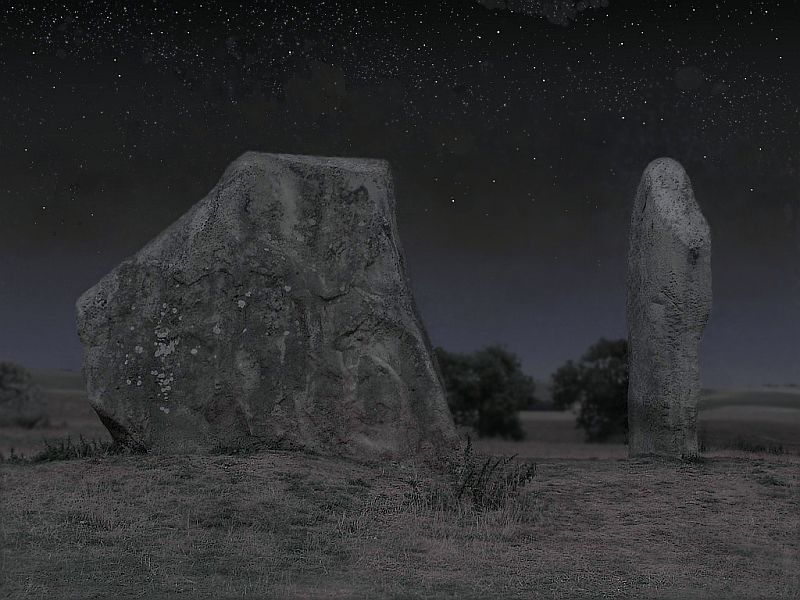
Avebury is the only place of the three linked sacred sites (avebury/stonehenge/silbury hill) that is free and accessible easily. Silbury is closed and is unstable at the moment due to past excavations. Its worth a look though if you're passing by.
http://www.crystalinks.com/avebury.html also http://www.mysteriousbritain.co.uk/e...bury-hill.html |
|
|
|
|
01-21-2009, 03:14 AM
|
#8 |
|
Avalon Senior Member
Join Date: Oct 2008
Posts: 403
|
Try this
http://www.mysteriousbritain.co.uk/map/wiltshire If not just go to the mysteriousbritain website, look under "england" and click on "wiltshire"...very useful map and link |
|
|
|
|
01-21-2009, 08:34 AM
|
#9 |
|
Avalon Senior Member
Join Date: Oct 2008
Location: Sandnes, Norway
Posts: 42
|
Thank you Czymra for thinking of your viking neighbor! We have very "long" countries here, so it should be possible to find a good spot here as well!
Love |
|
|
|
|
01-21-2009, 09:08 AM
|
#10 | |
|
Avalon Senior Member
Join Date: Nov 2008
Location: Germany
Posts: 1,151
|
Quote:
|
|
|
|
|
|
01-21-2009, 11:22 AM
|
#11 | |
|
Avalon Senior Member
Join Date: Oct 2008
Location: Sandnes, Norway
Posts: 42
|
Quote:
 Love |
|
|
|
|
|
01-21-2009, 02:07 PM
|
#12 | |
|
Avalon Senior Member
Join Date: Sep 2008
Location: It doesn't matter any more
Posts: 534
|
Quote:
Czymra, could you please amend the list? Thanks malletzky |
|
|
|
|
|
01-21-2009, 03:39 PM
|
#13 |
|
Avalon Senior Member
Join Date: Nov 2008
Location: Manitoba, Canada
Posts: 362
|
Jeesh - No Sacred Sites in Canada at all ???
Maybe I missed it when looking throught the List... That said - If there are no Sacred Sites in Canada - That may make It hard for Us Canucks to contribute as effectively as other Members Who have places in Their Countries where Sacred Sites are located... Hmmmmmm... 
|
|
|
|
|
01-21-2009, 05:08 PM
|
#14 |
|
Avalon Senior Member
Join Date: Sep 2008
Location: Southeast USA
Posts: 548
|
Blessings all!!
Firstly,there are many areas that we "modern" humans have never studied!,There are MANY places that have been studied but info has been suppressed! I am SURE there are places in Canada-we just don't know of them as well as other places. I strongly suggest sites that are natural springs or mountains or hills/mounds. We should ask tribesmen of the area where are sacred points-they have been there longer and have a sensativity many of us do not. The site that phiedpiper mentions last has co=ordinants of 127 places-Avebury and Sillsbury Hill are two distinct places although they are very close. It is also interesting to note that no one mentions points in Hawaii-although it is probably chalk full of points!!! I will be making a new list(that includes above places + new 100 sites)in alphabetical order & it will be seperated by country with info added of GMT and whom is Guide and a contact e-mail or name.I have found reference to places in China so will be adding this as well.I will also try to add co-ordinates. Those that understand what Astralwalker is saying and can help in configuring the points that will be used in Global Energy wave,it will take time. Please use what you can from the list and devide according to hemispheres.We probably should get some good atlas and use markers to mark off points and see where we need more people to come in.(Are we using the carl munck defined longitude & lattitude for the sacred points???) I will start by putting up my world map atlas and putting dots. Funny no one thought to do this before???? (Where in the world is carl munck???) In all-it will be work,but all will unfold-it is the time and we have hearts that are in the right place!! (thank you to peirs2210!! and to group in Ireland!!Just keep us posted !!) Sending Light and Love!! |
|
|
|
|
01-21-2009, 05:56 PM
|
#15 |
|
Avalon Senior Member
Join Date: Oct 2008
Location: Calgary, Canada
Posts: 711
|
http://www.sacredsites.com/
Martin Gray has gone to and studied over 1000 sacred sites. His site is great for learning the difference as well as to the power of the sites, such as if they are yin or yang, which are good for meditation. He alos goes on to which are the ones that are good for healing or enlightenment. Here is a video I highly recommend watching , where he talks about these things. http://www.consciousmedianetwork.com/members/mgray.htm Here are Canadian sites http://www.sacredsites.com/americas/canada/canada.html 1. Basilica of Ste. Anne de-Beau pre' 2. Soldier mountain (sacred to Ajumawi indians), Fall River valley 3. Montreal; St. Joseph's Oratory 4. Chief mountain, near Ft. Macleod 5. Mt. St. Elias 6. Great Sandhills, south Saskatchewan 7. Wanuskewin, 5 km north of Saskatoon 8. Moose mountain medicine wheel 9. Walbran valley, west coast of Vancouver Island Other sacred sites in Canada: Writing-on-Stone petroglyph site, 24 miles s/e of Lethbridge, Alberta Lac Sainte Anne, west of Edmonton, Alberta Medicine Lake, near Hidden Lake, southwest Alberta Majorville medicine wheel, south Alberta Valley of the Ten Peaks, Canadian Rockies near Calgary, Alberta Keremeos Mound, southeast British Columbia Cormorant Island, Alert Bay, eastern shores of North Vancouver Island, British Columbia Williams Lake (Columneetza Lake), Central British Columbia Petroglyph Park, west central coast of Vancouver Island, British Columbia Peterborough Petroglyphs, southern Ontario Martyrs Shrine and healing spring, Ontario Dreamers Rock vision quest site, Manitoulin Island, Ontario Vision quest stone ring, Bannock Point, Whiteshell Provincial Park, Manitoba Shrine of burial of Kateri Tekakwitha, Church of St. Francis-Xavier, Quebec Mission, Kahnawake Mohawk Reserve; 6m/se Montreal Tipperary Creek medicine wheel, central Saskatchewan Roy Rivers medicine wheel, southwest Saskatchewan Turtle medicine wheel, southeast Saskatchewan |
|
|
|
|
01-21-2009, 06:20 PM
|
#16 |
|
Avalon Senior Member
Join Date: Sep 2008
Location: Southeast USA
Posts: 548
|
Thank you judykott!
It also has places in hawaii,asia,africa,etc.!!! Good job!! People=we need volunteers for guides!! |
|
|
|
|
01-21-2009, 06:53 PM
|
#17 |
|
Avalon Senior Member
Join Date: Dec 2008
Posts: 105
|
I had wondered why Mt St. Elias was "off on its own" until I found this:
http://home.hiwaay.net/~jalison/easter2.html See the last image on the page! |
|
|
|
|
01-21-2009, 11:12 PM
|
#18 | |
|
Avalon Senior Member
Join Date: Nov 2008
Location: Germany
Posts: 1,151
|
Quote:
Malletzky, someone else allready corrected it. Thank you invisble Moderator. Phied, slowly I'm catching on how this works. That tutorial was great. Mudra, see you in Avebury. I can't fancy Stonehenge. |
|
|
|
|
|
01-21-2009, 11:20 PM
|
#19 | |
|
Avalon Spiritual Mother
Join Date: Sep 2008
Location: belgium
Posts: 4,919
|
Great to see U in Avebury Czymra
 Who else will be there ? Kindness mudra Quote:
Last edited by mudra; 01-22-2009 at 01:16 PM. |
|
|
|
|
|
01-22-2009, 03:09 AM
|
#20 |
|
Avalon Senior Member
Join Date: Oct 2008
Posts: 403
|
Thanks, Judykott for the great links.
The sacred sites website is a great site which i like to look at a lot. I mentioned it on the astralwalker thread too. Lovely. It says that Avebury is "the most significent sacred site of all of Britain if not the entire continent of Europe". (and its free and accessible by the way!!). Its also the largest known stone ring in the world. The link judy gave to martin gray's interview on consciousmedianetwork is essential viewing for anyone before they visit a sacred site. Its 41 minutes long and will teach you and surprise you with some of its info, as some of what we believe is conditioned and needs "undoing". These sites have a spiritual quality and power and you just need to "plug into the site" as Martin Gray says...there is nothing you should or shouldn't "do" at the site, the essence is just "to be there"...take it in. These sites have the ability to tell you more about yourself after you visit them. Enjoy, I'll definately be at Avebury! (and I'll walk over to Silbury Hill, though you cant go on the mound these days). |
|
|
|
|
01-22-2009, 06:48 AM
|
#21 |
|
Avalon Senior Member
Join Date: Oct 2008
Location: Calgary, Canada
Posts: 711
|
Based on the Becker Grid the sites he listed
No. Lat. Long. Description 1 31.72 N 31.2 E On the Egyptian continental shelf, in the Mediterranean Sea, at approximately the midpoint between the two outlets of the Nile at Masabb Rashid and Masabb Dumyat 2 52.62 N 31.2 E On the Sozh River east of Gomel, at the boundary junction of three Soviet republics - Ukraine, Bellorussia, and Russia 3 58.28 N 67.2 E In the marshy lowlands just west of Tobolsk 4 52.62 N 103.2 E In the lowlands north of the southern tip of lake Baykal, at the edge of highlands 5 58.28 N 139.2 E In the highlands along the coast of the Sea of Okhotsk 6 52.62 N 175.2 E Slightly east of Attu at the western tip of the Aleutian Islands 7 58.28 N 148.8 W Edge of continental shelf in the Gulf of Alaska 8 52.62 N 112.8 W Buffalo, Alberta, at the edge of highlands in lowlands 9 58.28 N 76.8 W Just east of Port Harrison on Hudson's Bay 10 52.62 N 40.8 W Gibbs Fracture Zone 11 58.28 N 4.8 W Loch More on the west coast of Scotland 12 26.57 N 67.2 E On the edge of the Kirthar Range bordering the Indus River Valley, directly north of Karachi 13 31.72 N 103.2 E At the east edge of the Himalayas in Szechuan Province, just West of the Jiuding Shan summit 14 26.57 N 139.2 E At the intersection of Kydshu Palau Ridge, the West Mariana Ridge, and the Iwo Jima Ridge 15 31.72 N 175.2 E At the intersection of Hess Plateau, the Hawaiian Ridge, and the Emperor Seamounts 16 26.57 N 148.8 W North East of Hawaii, midway between the Murau Fracture Zone and the Molokai Fracture Zone 17 31.72 N 112.8 W Cerro Cubabi, a highpoint just south of the US/Mexico border near Sonoita and lava fields 18 26.57 N 76.8 W Edge of continental shelf near Great Abaco Island in the Bahamas 19 31.72 N 40.8 W Atlantis Fracture Zone 20 26.57 N 4.8 W In El Eglab, a highland peninsula at the edge of the Sahara Desert sand dunes 21 10.81 N 31.2 E Sudan Highlands, at the edge of White Nile marsh fields 22 0 49.2 E Somali Abyssal Plain 23 10.81 S 67.2 E Vema Trench (in the Indian Ocean) at the intersection of the Mascarene Ridge, the Carlsberg Ridge and Maldive Ridge into the Mid-Indian Ridge 24 0 85.2 E Ceylon Abyssal Plain 25 10.81 N 103.2 E Kompong Som, a natural bay on the southern coast of Cambodia southwest of Phnom Penh 26 0 121.2 E At the midpoint of Teluk, Tomini, a bay in the northern area of Sulawesi 27 10.81 S 139.2 E Midpoint of the mouth of the Gulf of Carpentaria 28 0 157.2 E Center of Solomon Plateau 29 10.81 N 175.2 E Midpoint of abyssal plain between Marshall Islands, Mid Pacific Mountains and the Magellan Plateau 30 0 166.8 W Nova Canton Trough 31 10.81 S 148.8 W Society Islands 32 0 130.8 W Galapagos Fracture Zone 33 10.81 N 112.8 W East end of the Clipperton Fracture Zone 34 0 94.8 W Junction of the Cocos Ridge and the Carnegie Ridge, just west of the Galapagos Islands 35 10.81 S 76.8 W Lake Punrrun in Peruvian coastal highlands 36 0 58.8 W State of Amazonas, at tip of minor watershed highlands 37 10.81 N 40.8 W Vema Fracture Zone 38 0 22.8 W Romanche Fracture Zone 39 10.81 S 4.8 W Edge of Mid-Atlantic Ridge in Angola Basin just southeast of Ascension Fracture Zone 40 0 13.2 E Gabon highlands, at the intersection of three borders 41 26.57 S 31.2 E L'uyengo on the Usutu River in Swaziland 42 31.72 S 67.2 E Intersection of the Mid-Indian Ridge with the Southwest Indian Ridge 43 26.57 S 103.2 E Tip of the Wallabi Plateau 44 31.72 S 139.2 E In a lowland area just east of St. Mary Peak (highest point in the area) and north east of Rio de Janeiro 45 26.57 S 175.2 E At the edge of the Hebrides Trench, just southwestof the Fiji Islands 46 31.72 S 148.8 W Undifferentiated South Pacific Ocean 47 26.57 S 112.8 W Easter Island Fracture Zone 48 31.72 S 76.8 W Nazca Plate 49 26.57 S 40.8 W In deep ocean, at edge of continental shelf, southeast of Rio de Janeiro 50 31.72 S 4.8 W Walvis Ridge 51 58.28 S 31.2 E Enderby Abyssal Plain 52 52.62 S 67.2 E Kerguelen Plateau 53 58.28 S 103.2 E Ocean floor, midway between Kerguelen Abyssal Plain and Wilkes Abyssal Plain 54 52.62 S 139.2 E Kangaroo Fracture Zone 55 58.28 S 175.2 E Edge of Scott Fracture Zone 56 52.62 S 148.8 W Udintsev Fracture Zone 57 58.28 S 112.8 W Eltanin Fracture Zone 58 52.62 S 76.8 W South American tip, at the edge of the Haeckel Deep 59 58.28 S 40.8 W South Sandwich Fracture Zone 60 52.62 S 4.8 W Boivet Fracture Zone 61 North Pole 62 South Pole http://www.vortexmaps.com/chartres.php Notes: Megaliths around the world: Built at earth grid points. [Megalith: Large stone monument.] 1. Giza, the Great Pyramid 3. Tyumen oil field, USSR 4. Lake Baikal, USSR, many unique plants and animals 9. Hudson Bay, present location of north magnetic pole 11. Northern British Isles, Maes Howe, Ring of Brodgar, Callanish 12. Mohenjo Daro-Rama Empire culture 13. Pyramids in Xian, China, the largest in the world 14. Southern Japan Dragon's Triangle, great seismic activity 16. Hamakulta, nearby lies Hawaii, scene of high volcanic and earthquake activity 17. The sophisticated canal civilization of Cibola 18. Bimini, the site of huge man-made walls underwater, discovered in 1969, the date that Edgar Cayce had predicted that evidence of Atlantis would be discovered 20. Algerian megalithic ruin 21. Megaliths at Axum, the Coptic Christian center in Ethiopia 25. Bangkok and Angkor Wat 26. Sarawak, Borneo, site of ancient megalithic structures 28. Pohnpei Island, Micronesia, site of the megalithic city of Nan Madol 35. Lima, Peru, boundary of the Nazca Plate, Pisco, the Candlestick of the Andes & the Nazca Lines 40. Gabon, West Africa, natural atomic reactor in operation about 1.7 million years ago 41. Zimbabwe with its ancient mines & structures 44. The Maralinga Atomic Test Site, which also has megalithic ruins 47. Easter Island and its megaliths 62. German underground Antarctic base? http://www.vortexmaps.com/chartres.php The Mysteries of Chartres Cathedral, by Louis Charpentier The constellation of Virgo and the pattern of Notre Dames in France. NEXT: the authors. [my notes, reprinted without permission] AND MORE... Maurice Leblanc had...noted...that the Benedictine Abbeys of the Caux country trace on Earth the form of the Great Bear. ...fields which surround Glastonbury...befigure the twelve signs of the Zodiac. Charpentier p.31 [caption] The constellation of Virgo and the pattern of Notre Dames in Paris Charpentier p. 30 [caption] a dolmen... resembles the... xylophone. Charpentier p. 40 From the ogive the "creators" of Gothic went on to derive much more by a process of crossing it. They found the secret of the musical stone, the stone under tension, a secret lost when men lost the science of transporting the huge dolmen-tables. The crossed ogive is built on the principle of the transformation of lateral into vertical thrust. It is a sum of forces in which the vault no longer weighs down but springs upward under the lateral counterthrust of buttresses. If it is to last, the Gothic monument requires perfect adjustment between weight and thrust; the weight that creates the thrust becomes itself its own negation. The activity in the stone is therefore in a state of constant tension which the art of the master builder can tune like a harp string. For a Gothic cathedral is not only a musical instrument by similitude. The Gothic, built up on a dynamic of pressures, handles forces directed upwards. The Romanesque vault collapses, the Gothic leaps. ...One can easily see that this pile of stone so taut, according to Claudel, "that you could make it ring with a fingernail," is a replica of the dolmen and imitates its use of the telluric currents. pp. 43 - 49 12/ 10 is the interval of a third in music; the interval between the major and minor scales. p. 93 The square table at Chartres..."has obviously the same surface as the rectangular table... 23.192 m. But here we come on something extraordinary. The figure, 23.192 m, is strangely close to one tenth the side of the base of the Pyramid at Cheops... the surface of the pyramidal base is therefore one hundred times that of the Table of Chartres." p. 100 The so-called Druids cord with twelve knots and thirteen equal segments [illustration p. 103] And then, we have an astonishing fact. Apart from the carved screen, there was no sculpture within the cathedral at Chartres...The "tower of the choir" was begun in the XVIth century by Jean de Beauce...It is clear that immense pains were taken to deaden in no way the resonance of the building. One does not hang ornaments on a harp string. p. 177 We are now in a place that was chosen for human utilization of a telluric current that surfaces and must have close analogies with currents that are magnetic. Now, it is a well-known effect of an electric current that all bodies in movement through its field acquire particular properties. This is in fact the way electricity is made, by causing a rotor to revolve in a magnetic field, natural or artificial. p. 186 Chapter Sixteen The musical mystery pp. 137 - 146 The geometric scale [illustration] The transverse lengths correspond with the heights of the tone. "Cubit of Chartres" 0.738 meters: Width of the choir 20 units Length of the choir 50 units Length of the nave 100 units Length of the transept 90 units Height of the vault 50 units What then is this cubit of 0.738 meters? Quite simply, it is the hundred thousandth part of the degree of the parallel of latitude at Chartres. p. 128 Reims is situated at 49 degrees 14 minutes North latitude, which gives a degree of parallel of about 71 kilometers. The "measure" of "cubit" should therefore be 0.71 meters. The length of Reims cathedral is 142 meters and the interior length of the transepts is close to the geometrical mean between 71 and 35.5 meters. Amiens is situated at latitude 49 degrees 52 minutes North latitude, which would give a "cubit" of about 0.70 meters. The height of the vault is sixty times 0.70 meters and the length of the transepts is 70 meters. There are many other "coincidences". [illustration p. 130] For example, the measure having served for the determination of the plan, 0.82 and the cubit, 0.738, are together in an astonishing relationship. Take a right-angled triangle in which one of the angles is of 48 degrees. The long side of the right angle is 0.82 m, the short side 0.738 m. And Chartres is very close to 48 degrees. We have at once the ratio of this parallel to its height over the equator. p. 131 In "The Source of Measures", p. 172, Skinner says "Nork relates that the temple of Notre Dame in Paris, was formerly a temple of the goddess Isis, or the sign Virgo. On the temple was sculptured the zodiac with its signs; that of Virgo (Isis) was left out, because the whole temple was dedicated to her". http://www.vortexmaps.com/hexakis.php Grid Points: Yin, Yang & Balanced Grid points can be classified: Hot - Yang Cool - Yin Balanced This is a mercator-based hexakis icosahedron projection. http://www.vortexmaps.com/africa-grid-map.php Tree of Life on Map of Africa From Bethe Hagens and Wm. S. Becker World Grid/ Tree of Life on Africa Major points of the grid system are in bold. Labeled points from top to bottom and left to right: Findhorn Kiev Rome Dogon Constantinople Mt. Ararat Emi Koussi Tibesti Mountains, N. Chad Timbuktu - Algerian megaliths Giza Jerusalem Babylon Sumer Persepolis Mohenjo Daro Mecca Khartoum (path of the ecliptic) Ile Ife Namoratunga Leakey fossil finds Great Zimbabwe The "Tree of Life" is a symbol of sacred geometry from Jewish mysticism, Kabalah. History of the World Grid Theory NEXT: Chris Bird from New Age Journal "...the idea of the earth as a geometric shape goes back in history at least to the Pythagorean school of thinking in ancient Greece. Its famous adherent, Plato, wrote that the earth, viewed from above, resembles a ball sewn from twelve pieces of skin." [Bird] The last twenty years or so has generated a fleet of new grid theorists. A brief summary of their contributions follows in more-or-less chronological order. Ivan Sanderson The professional biologist who founded the Society for the Investigation of the Unexplained in Columbia, New Jersey, wrote "The Twelve Devils Graveyards Around the World" for Saga magazine in 1972. Reprinted in Paradox, by Nicholas R. Nelson, Dorrance & Co., Ardmore, Penn. 1980. "... with several associates, he set out to 'pattern the mysteries' by taking full advantage of modern communication technology and statistical data analysis. His success was startling. "The Twelve Devils Graveyards Around the World," plotted ship and plane disappearances worldwide, focusing attention on 12 areas, equally spaced over the globe, in which magnetic anomalies and other energy aberrations were linked to a full spectrum of strange physical phenomena. Highest on Sandersons statistical priority list was a lozenge-shaped area east of Miami, in the Bahamas, on the western tip of the infamous Bermuda Triangle. This areas "high profile" of strange events, Sanderson concluded, was mostly due to the enormous flow of air/ sea traffic in the area. Other zones of anomaly, though less familiar, were equally rich in disappearances and space-time shift occurrences. ... Another area of continuing disappearances and mysterious time-warps is the Devils Sea located east of Japan between Iwo Jima and Marcus Island. Here events have become so sinister that the Japanese government has officially designated the area a danger zone. Sanderson theorized that the tremendous hot and cold currents crossing his most active zones might create the electromagnetic gymnastics affecting instruments and vehicles. His theory is now being balanced against several." - -Anti-Gravity page 35. The Russian theorists credit Sanderson [see below]. Christopher Bird, in The Planetary Grid [New Age Journal, May, 1975 pages 36-41] reported to America from Russia: "On the last day of 1973, Komsomol's Pravda, the official newspaper for the Soviet Union's younger generation, ran a controversial article: "Earth, What Are You Anyway?" The story suggested that, far from being a simple spheroid, our globe started out as a crystal with angular dimensions. Only after millennia of motion and the actions of many forces did this crystal round itself into a ball. Certain Soviet scientists are now maintaining that the "boundaries" of the former crystal now lie buried and preserved within the body of our planet. Some of them may protrude, however imperceptibly, through its surface in the same way that parts of the skeleton bonily project through the taut skin of a thin or emaciated human or animal. Nikolai Goncharov, a Muscovite historian enthralled by the ancient world, knew nothing of these new and disputable theories. It occurred to him to mark on a globe all the centers of earliest human culture. Somewhere within him an "intuitive impulse," as the Russian youth newspaper put it, suggested that there might be a pattern, a geometric regularity, behind their genesis. It was only after Goncharov met Vyacheslav Morozov, a construction engineer, and Valery Makarov, a specialist in electronics, that his vague impulse became first a suspicion, then a hypothesis. After several years work, it appeared in Khimiya i Zhizn (Chemistry and Life), the popular science journal of the USSR Academy of Sciences under the title: "Is the Earth a Large Crystal?" The Russians also mention that Ivan Sanderson... has written that the triangle is not the only infamous region on the earth's surface but that there are nine others. The ten regions, says Sanderson, are symmetrically situated around the globe, five above, five below, at equal distances from the equator. Had the American investigator thought to add two more points, at the north and south poles, say the Russians, his scheme would have precisely coincided with the model which they have adopted. (The twelve points are 12, 14, 16, 18, 20, 41, 43, 45, 47, 49, 61, 62.) Bruce Cathie A retired military pilot in New Zealand, Cathie thought to plot unidentified aircraft sightings on a map, and found a grid pattern emerging. Author of Harmonic Conquest of Space, the latest in a series of books on the harmonics of the world grid. His article, Acoustic Levitation of Stones, appeared in Anti-Gravity. He has developed software to calculate light harmonics of global distances, called "Gridworks." Bethe Hagens with Bill Becker developed the EarthStar globe. "... the Earth [is] really a living crystal being with a geometric skeleton that could be mapped in its patterns of energy flows... in ocean currents, the winds, river systems, and distributions of precious minerals. It even seemed that ancient humans had known this sacred, hidden body of the Earth, and sited their civilizations to take advantages of her very visceral powers. [Dreaming] "I found a picture of the world with a funny lattice work on it. It looked an if someone had put one of Buckminster Fuller's domes over the planet, and the design caught my eye. As I read the accompanying article by Christopher Bird, I learned that was indeed what had been done. Three Russians (an engineer, a historian, and a linguist) had found that the dome-like geometric pattern could be aligned on the Earth in such a way that the struts of the dome mapped out major geologic features (such as mountain ranges and river systems), and the connecting points for the struts fell at the sites of important ancient civilizations. There were many other correlations, and the authors had numbered all of the corners so that information could be collected and compared among a variety of researchers all over the world." Bethes research pointed out that certain hand-held artifacts supported the world grid model. Namely, the geometric carvings described in Zink, wrongly called "bolas" [Rings]; and in two inscribed stones bearing related angles but otherwise unrelated, known as the Flagstaff Stone and the Clay County, Missouri Stone [Geostat]. Bethe showed that certain ancient maps were apparently based on the same system [Anti-Gravity]. "Probably the most significant discovery I made, though, involved great circles. A "great circle" is an equator. It cuts a "sphere" exactly in half. At first glance, the Earth crystal map appeared to me to be a web, like Spider Grandmother, but in fact it was a perfectly symmetrical cluster of fifteen great circles - or hoops - that created the illusion of one hundred and twenty identical triangles." [STRUTS missing from Russian model] It was not long after I discovered that many Sioux tribes refer to life force of Earth as "the fifteen hoops." More recently, Bethe has realized the EarthStar is a reflection of the sky. "...One night, as I sat (again) looking at a blank computer screen, I looked up at my celestial globe, and began thinking about Plato. If it [the world grid] really were a universal model of all creation, there should be fifteen hoops in the sky. I found that I could use the Earths path around the sun (the ecliptic) as the equator of the heavens, and a fifteen-hoop structure could be anchored to important places named in the worlds sky mythologies... the star Sirius, the Crab Nebula at the tip of Orions club, the Bear. Most amazing was that the ring of the Milky Way (as we see it in the sky) was exactly coincident with one of the hoops." [From Plato to Pluto]. Barbara Hero Her article, "International Harmony Based upon a Music of Planetary Grid Systems," first published in the United States Psychotronics Association 1985 annual Conference Proceedings, and was reprinted in Anti-Gravity. Correlates the earth grid system with specific musical notes, thus enabling one to find harmonic relationships related to distances between cities and countries. A chart of miles and corresponding musical notes is included so that one can determine the musically harmonic intervals. David D. Zink Ancient Stones Speak: A Journey to the Worlds Most Mysterious Megalithic Sites (Dutton 1979) "Until the present work, however, no one has pointed out the surprising number of megalithic structures located at or near these intersections." David Childress Edited Anti-Gravity and the World Grid, which brought together articles by Cathie, Hagens, Hero, Leviton and Zink; and distributes the EarthStar globe and other titles of interest. José Arguelles assigned the twenty Mayan day glyphs to the Earth in his Dreamspell game. Krsanna Duran writing in Perceptions presents a system of mapping the earth using the 20 Mayan glyphs; her system differs from Joses system. She divides the twenty points into five inter-penetrating tetrahedra. Dorothy Leon Able to see the energy lines, her map of western North America "The Wheel with Nineteen Spokes" she first released in Triangle from Mountains under the name Katrina (now out of print). [She sums up Triangle in Thirteen Steps of Ascension.] Her map corresponds closely with world grid points 8 and 19. It was redesigned slightly and published in 1995 by Dan Shaw under the name, "EarthStar North America". Peter Champoux Inspirator for ArkHom, a geometric map of the eastern United States, which nests within the earth grid. Peter is actively seeking to install monuments at key sites. Dan Shaw, Publisher of the EarthStar globe and EarthStar North America, realized that Dorothys "Wheel with Nineteen Spokes" plus the Grand Tetons at the center, equals 20, and he correlated the 20 Mayan day glyphs to the Wheel. Paul Devereux One of the greatest contributors to the science of geomancy, just retiring from 20 years editing The Ley Hunter journal. "Let my last editorial statement on our subject area be to point out that geomancy is in fact moving into a more modern, westernized area of concern (the only way our culture will absorb the geomantic lessons that have to be learned) that we could best describe as "cognitive". It brings earth mysteries into the arena of consciousness studies (I know this is a difficult transition for many people). [The Ley Hunter #124, Winter 1995/ 96 page 1]. (Paul is not directly tied to the world grid theory, but still merits mention here). |
|
|
|
|
01-22-2009, 06:49 AM
|
#22 |
|
Avalon Senior Member
Join Date: Oct 2008
Location: Calgary, Canada
Posts: 711
|
Spherical Geometry & 19.5 Degrees
throughout the solar system NEXT: The Piri Reis map 19.5 degrees north and south are the latitudes where the apex points of a star tetrahedra within a sphere will contact that sphere's surface, when one apex is positioned at the north or south pole. On the Sun: sunspot activity and the region of peak temperatures is limited to 19.5 degreees north and south. On Venus: the presumably active major volcano complexes Alpha and Beta Regio are near 19.5 degrees. On Earth: Mauna Loa, Hawaii (19 degrees 28 minutes N, 155 degrees 37 minutes W) The largest shield volcano is at 19.6 degrees north. This is Mauna-Kea volcano on the island of Hawaii. Mexico City, Mexico (19 degrees 23 minutes N, 99 degrees 10 minutes W) The Pyramid of the Sun at Teotihuacan is at 19.6 degrees north. Dzibalchen, (Yucatan), Mexico (19 degrees 28 minutes N, 89 degrees 46 minutes W) Georgetown, Grand Cayman Island (19 degrees 18 minutes N, 81 degrees 26 minutes W) Mount Emi Koussi, Chad, Africa (19 degrees 47 minutes N, 18 degrees 34 minutes E) Mount Kalsubai, (near Bombay), India (19 degrees 33 minutes N, 73 degrees 43 minutes E) Mountain near Xiangkhoang, Laos (19 degrees 17 minutes N, 103 degrees 17 minutes E) Mountain near Potosi, Bolivia (19 degrees 13 minutes S, 66 degrees 22 minutes W) Yasur Volcano, Tanna Island, Vanuatu (South Pacific Ocean) (19 degrees 31 minutes S, 169 degrees 25 minutes E) Mount Samuel, Northwest Territory, Australia (19 degrees 13 minutes S, 134 degrees 8 minutes E) Gweru, Zimbabwe, Africa (19 degrees 31 minutes S, 29 degrees 49 minutes E) On Mars: the "vast" Olympus Mons shield cone volcano is at 19.5 degrees. On Jupiter: the "red spot" which is an obvious vortex is at 19.5 degrees. On Neptune: in 1986 Voyager II discovered a similar spot at 19.5 degrees north. Based on Richard Dannelley's book, Sedona: Beyond the Vortex and Bruce Rawles Why '19.5 degrees' is Significant 19.5 degrees is the angle that's been found by researchers (Richard C. Hoagland, Stanley McDaniel, Erol Torun, Horace W. Crater, etc.) to be repeatedly encoded in the structures of Cydonia. It is viewed as a definite 'signal in the noise' - some kind of a 'message' left there by some intelligence. 19.5 is called t, the 'tetrahedral constant', because of its significance in tetrahedral geometry (a tetrahedron is a pyramid shape composed of four equilateral triangular sides): the apexes of a tetrahedron when placed within a circumscribing sphere, one of the tetrahedron's apexes touching the north pole, the other three apexes touch the surface of the sphere at 19.5 degrees south latitude. Why this number would be important to the builders of the Martian structures is not clear (though Hoagland is theorizing that it has to do with what he calls "hyperdimensional physics"). Nile Time-Map & tetrahedral geometry -- 19.5 degrees http://prophetic.simplenet.com/elysium/nile-timemap.htm The emphasis on 19.5 degrees is not confined to the Martian structures. It has been found to be associated with various ancient structures here on earth - Giza pyramids, Avebury (the largest stone circle in the world, near Stonehenge), Pyramids of the Sun and Moon at Teotihuacan, etc. It is also worth noting that the Egyptian hieroglyph for Sirius, the brightest star in the sky which was extremely important to ancient Egyptians, is an equilateral triangle which can be viewed as a 2-dimensional representation of a tetrahedron; and in the Egyptian translation, it means a doorway... a sort of 'stargate'. Curiously, it has also been observed that 19.5 degrees is closely linked, for some reason, with the NASA space missions (for example, Mars Pathfinder landed at 19.5 degrees lat. of Mars on July 4, '97). In fact, not only did Pathfinder landed at 19.5 N, the longitude of the landing site was approximately 33 W - which is the very number of the longitude of the apex of the Great Bend of the Nile (33 E)! Now, this strongly insists on the relevance of the Nile numbers, and someone behind the scenes is well aware of it. As we move on, the number, 19.5, will also be very important in my Nile Time-map theory. Perhaps, as the Nile-Mars connection bridged by '19.5' appears to suggest, Mars was somehow involved during the 'Prometheus / Pandora period'. |
|
|
|
|
01-22-2009, 06:50 AM
|
#23 |
|
Avalon Senior Member
Join Date: Oct 2008
Location: Calgary, Canada
Posts: 711
|
-- ------------------------------------------------------------------------------
http://205.209.69.90/grid_files/Expl...le%20Earth.doc Basic Instructions for Exploring the UVG Grid with Google Earth Bethe Hagens SETTING UP GOOGLE EARTH The basic Google Earth program is available for PC and Macfree!at http://earth.google.com. SETTING UP and SHARING THE UVG Grid compiled by B. Hagens FILE Download, but do not try to open, the file to a convenient location on your computer. Open up GoogleEarth. In the upper left corner of the Google Earth screen, click File. Then click Open. You will be able to browse to where you have saved UVG Grid compiled by B. Hagens. Click on it, and the UVG Grid file will appear in Google Earth in the Places-Temporary menu on the left. This file is ©Bethe Hagens 2006 and is not for sale. Please feel free to share it. VIEWING AND HIDING LINES You can view the UVG Grid in many ways. If you click on the little triangle next to a file or folder name, and a dropdown menu appears. Click on the check mark by the title of any folder or file, and everything in that it disappears from the screen. Click the same spot, and it reappears. If you go into the folder titled Regular Geometric Solids, you can see subfolders and can look at (or hide) all of the different geometric figures and great circles that make up the UVG Grid. The edges of many of the figures overlap each other, and sometimes meet up to create great circles. Every line of the UVG is part of a great circle (equator) that divides the sphere of Earth in half. This is the major change that Bill Becker and I made to the planetary grid model (shown here) proposed in the 1970s by three Russian men Makarov (an engineer), Morozov (a linguist), and Goncharov (a historian). I visited Makarov in Moscow in 1994, and he told me that they believed the dodecahedron was fundamental. It aligned very closely with the mid-Atlantic ridge. That was their beginning orientation. Archaeological alignments (such as Pt. 1 being so close to the Great Pyramid) became visible later. Bill Becker, with whom I worked closely on this project for 12 years from 1981 until 1993, was a colleague of Buckminster Fuller. Bills first impression of the Russian grid was that it was an incomplete synergetic structure. He realized that the red arrows of force coincided with a figure relatively unknown at the timethe rhombic tetrahedron. This figure is now a staple of the new carbon 3 geometries and quasicrystal research. By adding these line segments, we discovered that the entire grid was composed of 15 great circles (hoops)which tied it to Lakota creation mythology. The 15 hoops created 120 identical right triangleswhich tied it exactly to Platos description of the divine feminine receptacle in Timaeus. The Basic UVG Gridconceptualized as a crystal, each of the triangles having a flat surfacewould be called a hexakis icosahedron. We believe the synergetic structural principles of this geometry are system characteristics of Earth. COLOR CODING The vertices (corners) of all five Platonic Solidsand two other diamond-faced regular figures, the rhombic triacontahedron and rhombic dodecahedronalign with the 62 grid points (corners) of the Basic UVG Grid (a spherical hexakis icosahedron). Several of the figures can be positioned within the 62 points of the Grid in more than one way. A tetradhedron, for example, will align in 10 different positions. The UVG Grid maps all of these different possibilities. In the list below, the number in parentheses after the name of a figure indicates the number of placements that are possible. Line Color Geometric Association Esoteric Meaning Red Tetrahedron edges (10) Fire Yellow Cube edges (5) Earth White Octahedron edges (5) White Black Icosahedron edges (1) Water Green Dodecahedron edges (1) Aether Dark Blue Rhombic Dodecahedron (5) Violet Rhombic Triacontahedron (1) Buckminster Fullers Icosahedral Great Circle Set Orange Yang great circles Each circle connects antipodal vertices of the Dodecahedron through two octahedra vertices Light Blue Yin great circles Each circles connects antipodal vertices of the Icosahedron through two octahedra vertices Lime Green Balance great circles Each circles connects antipodal octahedron vertices through eight octahedra vertices ADDING OTHER LINES AND GRIDS In the lower right hand corner, click the push-pin icon, then click Path in the drop-down menu. You will then need to purchase and download Google Earth Plus if you don't already have it. This will cost you just $20/year. Then you can draw lines and add overlays. (Google Earth Pro will allow you to make animations, but it costs $400/year.) Clicking on Path in Google Earth Plus allows you to name and choose a location to save your path (line). The "Advanced" tab in the dialog box lets you select color, width, etc. of the line. Also, you can choose the altitude at which you want to draw your lines. You must keep the Path dialog box open while you are creating your line. (Just shrink the box and move it to the side.) If you click OK, the dialog box will close and appear somewhere in the drop-down menu on the left side of the screen. To open it back up, left click the name youve given the path, right click the name to see the drop-down menu, and choose Edit. with a left click. Then you can create your line and/or add as many line segments as you want. The editing and saving is just plain clumsy, and you have to be patient. When the Path dialog box is open, youll mark a beginning point and/or a line segment to any point on the screen that you left click. Use the navigation dial at the bottom center of the screen to move to the location you want. You can delete line segments moving backwards from where you are by right clicking. Every right click removes the previous segment, so you need to keep your attention focused :-) Clicking the Fly To command at the upper left of the screen can be really useful. If you enter a location (name or Lat/long coordinates) in the box just below Fly To and click Go, it will take you to that location and then store it in the space below. You can use either decimals or degree-minute-sec coordinates (+ and -, or NSEW). By left clicking an entry in the Fly Tospace, then right-clicking to open a drop-down menu, you can edit and rename and so forth. If you double left-click an entry, you will fly to the location. When the Path dialog box is open, the only way you can get to a location quickly is to type its coordinates into the Fly To box. BEWARE!! If you close Google Earth, all the locations in the space below Fly To disappear. I havent found a way to save them there. The advantage to working at a very low altitude setting is that you can be accurate and you can make a loop path. You cannot click exactly on top of a point you've already made, so the low altitude lets you eliminate too much error. The program is pretty intuitive, and you'll quickly get the hang of it. Im about to launch my first website www.World Geometry.com, but not sure how soon. For now, its bethehagens@adelphia.net. Download the grid info from this page http://205.209.69.90/grid |
|
|
|
|
01-22-2009, 09:26 AM
|
#24 |
|
Avalon Senior Member
Join Date: Nov 2008
Location: Germany
Posts: 1,151
|
Wow, thank you!
|
|
|
|
|
01-22-2009, 09:38 AM
|
#25 |
|
Avalon Senior Member
Join Date: Sep 2008
Location: devon england
Posts: 1,905
|
thanks to all for the hard work and commitments.
i will be at Avebury , its a truely beautifull area . look forward to meeting some of you there . in loving rhythmm ,may all beings be. |
|
|
|
|
«
Previous Thread
|
Next Thread
»
 Linear Mode

|
|

All times are GMT. The time now is 05:40 AM.